Flood situation in Lapland is calm - higher rainfall than predicted may exacerbate the situation (Lapland)
Information provided by the ELY Centre for Lapland and the Flood Centre
The floods in Lapland are gradually calming down. In Rovaniemi, the water level has fallen slightly but it is still above the damage limit. The flood is expected to start falling in the next few days. In Kittilä, the water level has remained slightly below the damage limit for several days. Rainfall in the next days may cause the water to rise above the damage limit but the flood is expected to stay well below the level of the flood of 2005. In Ivalo, water levels showed signs of going down at the end of the week, but water levels have now slightly risen again. In the Tornionjoki River, the flood peak is not expected until the next week.
In Rovaniemi, the flood exceeded the damage limit on Friday night and was at its highest on the night between Saturday and Sunday (at Lainaa observation station N2000+77.62 metres). At the Valajaskoski observation station, the maximum flow rate 4,147 m3/s was measured on Saturday. The water level has already dropped slightly, and it is predicted that the falling of the water level will accelerate in the next few days. The volume of the flood was very close to the same level than in 1973 and 1993.
In Kittilä, the flood in Ounasjoki has remained slightly below the damage limit for four days. This morning, the water level at the observation station in the village center was at N60+176.71 metres. The predicted rainfall in the catchment area should melt the rest of the snow which may slightly increase the water level. The flood will clearly be smaller than the major flood of 2005.
The first flood peak in Ivalojoki occurred on Friday, after which flows and water levels have decreased slightly. Because of the melting of the rest of the snow and predicted rainfall, it seems there will be a second flood peak, but the flow is not likely to rise much higher than the figures measured on Friday. Due to the slow melting of snow over a longer period of time and the sunny weather, the flood will likely be smaller than the major flooding in previous years.
According to the forecast, the flood peak in Tornionjoki will only occur on the latter half of the next week. The water level will probably rise 0.5-1 metres more, and the maximum flows are estimated to be approximately 2,700-3,000 m3/s. The flood will be smaller than the 1968 record flood. In the Pello area, the water level is expected to stay slightly below the damage limit.
Situation on roads
Due to the flood, road 19618 Kainuunkyläntie in Ylitorniemi is currently closed. Current traffic information https://liikennetilanne.tmfg.fi
Further information on the road network: Kari Parikka, Maintenance Officer, tel. +358 295 037 247
Monitor the flood situation
The Lapland Rescue Department took over the overall management responsibility for the flood situation in Lapland on 1 June 2020. In the future, the Rescue Department will lead the authorities and NGOs in their efforts in the flood areas, compile a flood situation map and report on the situation on a daily basis.
The next flood bulletin from the ELY Centre for Lapland and the Flood Centre concerning the Lapland area will be issued on Friday, and the situation will also be reported on e.g. Twitter. If the situation changes from the forecast, it is immediately reported. You can find the flood forecast and warnings map on the national www.ymparisto.fi/tulvatilanne (in Finnish) website. Forecasts are updated every few hours.
More information:
Chief Specialist, Water Resources Engineering Timo Alaraudanjoki, Lapland ELY Centre, tel. 0295 037 282, First [email protected]
Leading hydrologist Bertel Vehviläinen, Finnish Environment Institute (Flood Centre), tel. 0295 251 731 First [email protected]
Instructions for preparing for floods
- Lapland Rescue Department's Flood 2020 website (in Finnish)
- How do I prepare for floods and what do I do if I get caught up in a flood?
- Guide for residents - independent preparation for floods (in Finnish)
Share your flood observations with the Weather app
Joint bulletins from the ELY Centre for Lapland and the Flood Centre and bulletins from the Finnish Emergency Services for Lapland
- Press releases from the ELY Centre for Lapland and the Flood Centre
- Lapland Emergency Services bulletins(daily)
Monitoring the flood situation
- The flood situation throughout Finland can be monitored in almost real time on the national watershed forecasts and warnings website Hydrological situation and forecasts
- Constantly updated map: Watershed forecasts and flood warnings
- You can also find the hydrological situation and press releases on the new vesi.fi service (in Finnish)
- Current traffic information: TMFG traffic situation service
- The joint flood information site of all ELY centres (in Finnish)
- Lapland Rescue Department's Lapland's Flood 2020 website (in Finnish)
- #tulva OR #tulvat ja #Lapintulvat (floods in Twitter In Finnish)
- @pinnanalta (SYKE hydrologists)
- @Lapin_ELY (ELY Centre for Lapland)
- @meteorologit (Finnish Meteorological Institute)
- @Lapinpelastus (Lapland Rescue department)
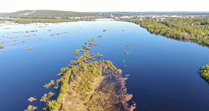 Ounasjoki, Rovaniemi 1.6.2020