The flood situation in Lapland will remain calm for the next few days - major flooding still a risk in June (Lapland)
Information provided by the ELY Centre for Lapland and the Flood Centre
Lapland's rivers are not likely to cause major floods in the next few days as cool weather has caused snow to melt more slowly than usually. There is still a risk of major flooding at the beginning of June; after this cold spell, temperatures can rise significantly faster than anticipated which means that continuous snow melt might rapidly increase river flow. If warmer weather is accompanied by heavy rainfall, the situation will become serious. More information will be given on weather forecasts over the next few weeks.
The timing of the flood peaks in the large rivers of Lapland is still predicted to be early June. The Simojoki area is an exception; there the time of the heaviest flow is forecast after mid-May. In other parts of Lapland, flood peaks can already occur at the end of May if temperatures start to rise significantly faster than anticipated.
Unprecedented floods are possible in almost all waters in Lapland. The most vulnerable areas are Kittilä and Rovaniemi in the Kemijoki river basin and Pello in the Tornionjoki-Muonionjoki river basin. In these areas, flooding is expected to exceed the damage limit.
According to the most recent water system forecast, the snow will melt over a longer period of time than usually which slightly reduces the risk of major flooding. In Southern Lapland, the snow layer has thinned in early May but in other parts of Lapland, levels of water equivalent of snow remain exceptionally high.
In Lapland, Simojoki and the river areas in the lower and middle parts of Kemijoki have already almost totally lost ice. In the Tornionjoki and Ivalojoki streams, long stretches have already melted. The risk of ice jams is assessed to be low as the slowly progressing spring and gradually strengthening water flow significantly weaken the remaining ice.
The next flood report will be issued in the week 21, and information on the flood situation will be given on multiple channels including Twitter. You can find the flood forecast and warnings map on the national www.ymparisto.fi website. Forecasts are updated every few hours.
More information:
Chief Specialist, Water Resources Engineering Timo Alaraudanjoki, Lapland ELY Centre, tel. 0295 037 282, [email protected]
Leading hydrologist Bertel Vehviläinen, Finnish Environment Institute, tel. 0295 251 731 (Flood Centre), [email protected]
Instructions for preparing for floods
- Lapland Rescue Department's Flood 2020 website (in Finnish)
- How do I prepare for floods and what do I do if I get caught up in a flood? (in Finnish)
- Guide for residents - independent preparation for floods (in Finnish)
Share your flood observations with the Weather app
Joint press releases from the ELY Centre and the Flood Centre
- Press releases from the ELY Centre for Lapland and the Flood Centre
Monitoring the flood situation
- The flood situation throughout Finland can be monitored in almost real time on the national watershed forecasts and warnings website Hydrological situation and forecasts
- Constantly updated map: Watershed forecasts and flood warnings
- You can also find the hydrological situation and press releases on the new vesi.fi service (in Finnish)
- Current traffic information: TMFG traffic situation service
- The joint flood information site of all ELY centres (in Finnish)
- Lapland Rescue Department's Lapland's Flood 2020 website (in Finnish)
- #tulva OR #tulvat ja #Lapintulvat (floods in Twitter In Finnish)
- @pinnanalta (SYKE hydrologists)
- @Lapin_ELY (ELY Centre for Lapland)
- @meteorologit (Finnish Meteorological Institute)
- @Lapinpelastus (Lapland Rescue department)
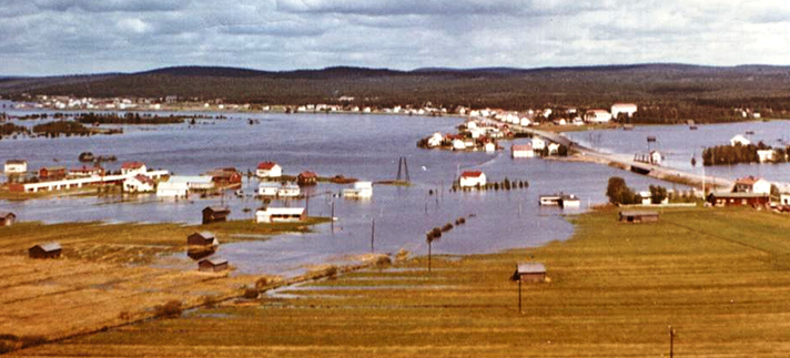
Photo: Pello 1968, Esko Ylitalo